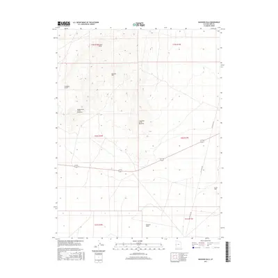
2017 Map of Buckskin Hills
USGS Topo · Published 2017About this map
The Conger Range and Buckskin Hills dominate this section of Millard County, where the high desert terrain transitions into the expansive Ferguson Desert to the south. This 2017 survey details a landscape defined by significant ridges and drainages, notably Livingston Canyon and prominent landforms such as Middle Point of the Buckskins and Long Point of the Buckskins. Human infrastructure is sparse, primarily represented by the path of Little Valley Rd and a few improved tracks navigating the basins. Near the southeastern corner, the land rises to the Crows Nest, illustrating the isolated, high-elevation topography typical of this Great Basin environment. The map preserves the township and range divisions, providing a clear reference for those studying land management and ranching history in the arid West.
Find a feature on this map
14 named features on this map. Tap any name to fly to it.
Don’t see what you’re looking for? This feature index may not catch every label — zoom into the map to look around manually.
Map Details
Editions of this 2017 Buckskin Hills Map
This is the sole edition of this map. No revisions or reprints were ever made.
Other maps of this area

1908 · Fish Springs
USGS Topo · 1:250,000

1910 · Fish Springs
USGS Topo · 1:250,000

1953 · Richfield
USGS Topo · 1:250,000

1953 · Delta
USGS Topo · 1:250,000

1958 · Richfield
USGS Topo · 1:250,000

1958 · Delta
USGS Topo · 1:250,000

1960 · Conger Range
USGS Topo · 1:62,500

1960 · Burbank Hills
USGS Topo · 1:62,500

1960 · Crystal Peak
USGS Topo · 1:62,500

1960 · Conger Mountain
USGS Topo · 1:62,500