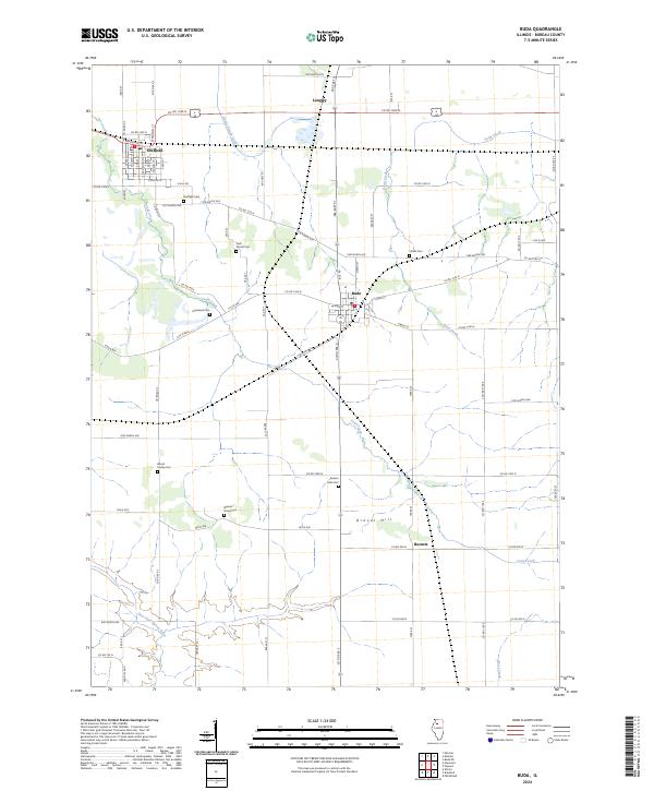
2024 Map of Buda
USGS Topo · Published 2024About this map
Buda and Sheffield anchor this Bureau County landscape, where the local economy and settlement patterns are defined by a network of agricultural roads and rail-side commerce. The quadrangle is particularly dense with small, localized burial grounds like Wood Family Cem and Walnut Grove Cem, which serve as vital markers for genealogical research in this rural corridor. The terrain is shaped by the winding paths of Coal Creek and the East Fork Spoon River, with Gravel Hill providing a rare named topographic point of interest south of Buda. This modern survey reveals how the townships maintain their late 19th-century grid while preserving early landmarks like Saint Patrick Cem and Fifield Cem. Smaller junctions such as Langley and Burnett further define the historic geography of the Illinois prairie.
Find a feature on this map
79 named features on this map. Tap any name to fly to it.
Don’t see what you’re looking for? This feature index may not catch every label — zoom into the map to look around manually.
Map Details
Editions of this 2024 Buda Map
This is the sole edition of this map. No revisions or reprints were ever made.
Other maps of this area

1921 · Buda
USGS Topo · 1:62,500

1923 · Buda
USGS Topo · 1:62,500

1929 · Annawan
USGS Topo · 1:62,500

1932 · Annawan
USGS Topo · 1:62,500

1933 · Camp Grove
USGS Topo · 1:48,000

1944 · Kewanee
USGS Topo · 1:62,500

1945 · Bradford
USGS Topo · 1:62,500

1958 · Aurora
USGS Topo · 1:250,000

1961 · Aurora
USGS Topo · 1:250,000
1983 · Buda NE
USGS Topo · 1:24,000