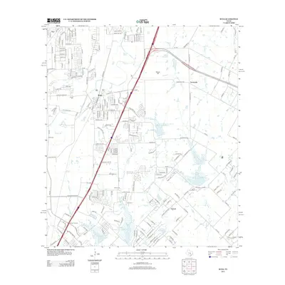
2013 Map of Buda
USGS Topo · Published 2013About this map
Buda and the surrounding Hill Country suburbs appear in high detail during a period of rapid residential expansion south of Austin. The corridor along the Union Pacific RR serves as a primary axis for the town, while the landscape to the east at Turnersville and Goforth remains more rural, defined by agricultural plots and several water management projects. These include the Soil Conservation Service Site 12 Reservoir and the Soil Conservation Service Site 10 Reservoir along Brushy Cr. Historical sites like Manchaca Springs and a series of family and community burial grounds, including Antioch Cem, Allen Cem, and Martin Church Cem, provide a grounded connection to the area's pioneer roots. The map also captures industrial footprints like the Gravel Pit and the infrastructure surrounding Cement Plant Rd, illustrating the region's balance between residential growth and resource extraction.
Find a feature on this map
215 named features on this map. Tap any name to fly to it.
Don’t see what you’re looking for? This feature index may not catch every label — zoom into the map to look around manually.
Map Details
Editions of this 2013 Buda Map
This is the sole edition of this map. No revisions or reprints were ever made.
Other maps of this area

1896 · Austin
USGS Topo · 1:125,000

1897 · Austin
USGS Topo · 1:125,000

1910 · Austin
USGS Topo · 1:125,000

1911 · San Marcos
USGS Topo · 1:125,000

1919 · San Marcos
USGS Topo · 1:125,000

1930 · Lockhart
USGS Topo · 1:62,500

1953 · Seguin
USGS Topo · 1:250,000

1954 · Austin
USGS Topo · 1:250,000

1955 · Montopolis
USGS Topo · 1:24,000

1955 · Oak Hill
USGS Topo · 1:24,000