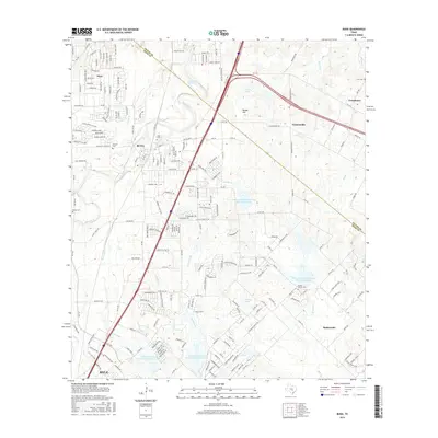
2016 Map of Buda
USGS Topo · Published 2016About this map
Buda and Kyle serve as the primary hubs in this suburbanizing landscape along the Travis and Hays County line during the mid-2010s. The region is characterized by a mix of established residential developments and significant water management infrastructure, including several engineered reservoirs such as Soil Conservation Service Site 10 Reservoir and Lake Number 1. Historical continuity is preserved through numerous family and community burial grounds, including Antioch Cem and Martin Church Cem, which sit alongside evolving settlements like Turnersville and Creedmoor. The terrain rises toward Paradise Mountain and Woods Hill, while the drainage network of Onion Cr and its tributaries, such as Garlic Cr and Mustang Br, dictates the local geography. This survey provides a clear view of the intersection between historic rural outposts and the expanding infrastructure of Central Texas.
Find a feature on this map
211 named features on this map. Tap any name to fly to it.
Don’t see what you’re looking for? This feature index may not catch every label — zoom into the map to look around manually.
Map Details
Editions of this 2016 Buda Map
This is the sole edition of this map. No revisions or reprints were ever made.
Other maps of this area

1896 · Austin
USGS Topo · 1:125,000

1897 · Austin
USGS Topo · 1:125,000

1910 · Austin
USGS Topo · 1:125,000

1911 · San Marcos
USGS Topo · 1:125,000

1919 · San Marcos
USGS Topo · 1:125,000

1930 · Lockhart
USGS Topo · 1:62,500

1953 · Seguin
USGS Topo · 1:250,000

1954 · Austin
USGS Topo · 1:250,000

1955 · Montopolis
USGS Topo · 1:24,000

1955 · Oak Hill
USGS Topo · 1:24,000