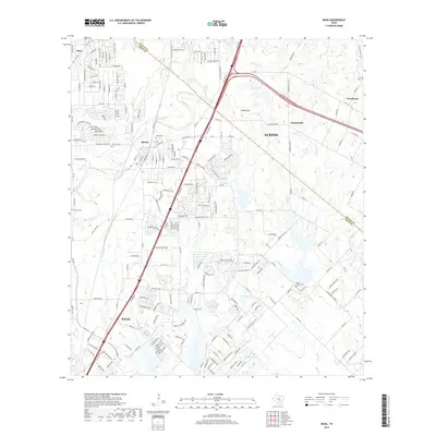
2019 Map of Buda
USGS Topo · Published 2019About this map
Buda and the northern edge of Kyle anchor this corridor of rapid central Texas development during the late 2010s. The landscape is defined by the heavy infrastructure of I-35, which bisects the quadrangle as it moves toward Austin. Despite modern growth, the map preserves the locations of numerous family and community landmarks essential for local history. Small cemeteries like Antioch Cem, Allen Cem, and Barton Cem are scattered across the terrain, often near older watercourses such as Onion Creek and Garlic Creek. To the east, the rural character persists around Creedmoor and Turnersville, where the drainage of Brushy Creek and Rinard Creek creates a complex network of smaller tributaries. Notable landmarks like Manchaca Springs and the Martin Church complex provide historical touchstones in a region transitioning from agricultural ranch land to a suburban residential hub.
Find a feature on this map
41 named features on this map. Tap any name to fly to it.
Don’t see what you’re looking for? This feature index may not catch every label — zoom into the map to look around manually.
Map Details
Editions of this 2019 Buda Map
This is the sole edition of this map. No revisions or reprints were ever made.
Other maps of this area

1896 · Austin
USGS Topo · 1:125,000

1897 · Austin
USGS Topo · 1:125,000

1910 · Austin
USGS Topo · 1:125,000

1911 · San Marcos
USGS Topo · 1:125,000

1919 · San Marcos
USGS Topo · 1:125,000

1930 · Lockhart
USGS Topo · 1:62,500

1953 · Seguin
USGS Topo · 1:250,000

1954 · Austin
USGS Topo · 1:250,000

1955 · Montopolis
USGS Topo · 1:24,000

1955 · Oak Hill
USGS Topo · 1:24,000