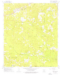
1962 Map of Buena Vista
USGS Topo · Published 1976About this map
The extraction of energy resources dominates the southern landscape of this 1962 survey, where the Gum Creek Oil and Gas Field, Wesgum Oil and Gas Field, and Pace City Oil and Gas Field mark the heavy industrial presence near the border of Ouachita and Union Counties. This industrial network is centered around the settlement of Pace City, while further north, the community of Buena Vista sits along the Southwestern St Louis railroad line.
Find a feature on this map
35 named features on this map. Tap any name to fly to it.
Don’t see what you’re looking for? This feature index may not catch every label — zoom into the map to look around manually.
Map Details
Editions of this 1962 Buena Vista Map
2 editions found
Other maps of this area

1901 · Gurdon
USGS Topo · 1:125,000

1903 · Camden
USGS Topo · 1:125,000

1951 · Camden
USGS Topo · 1:24,000

1953 · El Dorado
USGS Topo · 1:250,000

1957 · El Dorado
USGS Topo · 1:250,000

1958 · El Dorado
USGS Topo · 1:250,000

1960 · El Dorado
USGS Topo · 1:250,000

1962 · Lisbon
USGS Topo · 1:24,000

1962 · Louann
USGS Topo · 1:24,000

1962 · Buena Vista
USGS Topo · 1:24,000