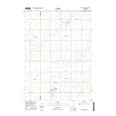
2015 Map of Buffalo Center
USGS Topo · Published 2015About this map
The town of Buffalo Center anchors the southern portion of this northern Iowa survey, situated along the border of Kossuth and Winnebago counties. The landscape is defined by the highly managed waterways necessary for prairie agriculture, including the channelized Middle Br Blue Earth River and engineered systems such as Drainage Ditch Number 21 and Drainage Ditch Number 64. These drainage networks reflect the conversion of the Iowa-Minnesota borderlands into a productive agricultural grid.
Find a feature on this map
68 named features on this map. Tap any name to fly to it.
Don’t see what you’re looking for? This feature index may not catch every label — zoom into the map to look around manually.
Map Details
Editions of this 2015 Buffalo Center Map
This is the sole edition of this map. No revisions or reprints were ever made.
Other maps of this area

1954 · Fairmont
USGS Topo · 1:250,000

1954 · Mason City
USGS Topo · 1:250,000
1955 · Bricelyn
USGS Topo · 1:62,500

1957 · Mason City
USGS Topo · 1:250,000

1958 · Mason City
USGS Topo · 1:250,000
1958 · Fairmont
USGS Topo · 1:250,000
1967 · Elmore
USGS Topo · 1:24,000
1972 · German Valley
USGS Topo · 1:24,000
1972 · Buffalo Center
USGS Topo · 1:24,000
1972 · Buffalo Center SW
USGS Topo · 1:24,000