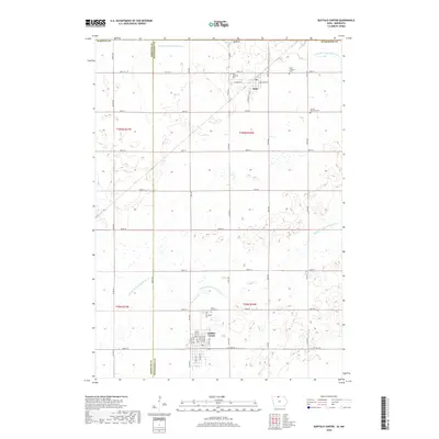
2018 Map of Buffalo Center
USGS Topo · Published 2018About this map
Buffalo Center and Rake anchor this agricultural landscape in northern Iowa near the Minnesota border. The terrain is defined by an extensive water management network, including Drainage Ditch Number 21 and Drainage Ditch Number 64, which support the intensive farming characteristic of the region. The Middle Br Blue Earth River winds through the central and southern sections, providing a natural contrast to the rigid grid of county roads such as Co RD r20 and Co RD a16. Genealogists will find several notable burial sites including Olena Mound Cem and Graceland Cem near Buffalo Center, as well as the Lincoln Township Cem further east. These cemeteries, along with West Lutheran Cem and East Lutheran Cem, serve as primary landmarks for tracing family histories across the townships of Winnebago and Kossuth counties.
Find a feature on this map
48 named features on this map. Tap any name to fly to it.
Don’t see what you’re looking for? This feature index may not catch every label — zoom into the map to look around manually.
Map Details
Editions of this 2018 Buffalo Center Map
This is the sole edition of this map. No revisions or reprints were ever made.
Other maps of this area

1954 · Fairmont
USGS Topo · 1:250,000

1954 · Mason City
USGS Topo · 1:250,000

1955 · Bricelyn
USGS Topo · 1:62,500

1957 · Mason City
USGS Topo · 1:250,000

1958 · Mason City
USGS Topo · 1:250,000

1958 · Fairmont
USGS Topo · 1:250,000

1967 · Elmore
USGS Topo · 1:24,000

1972 · German Valley
USGS Topo · 1:24,000

1972 · Buffalo Center
USGS Topo · 1:24,000

1972 · Buffalo Center SW
USGS Topo · 1:24,000