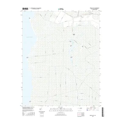
2016 Map of Buffalo City
USGS Topo · Published 2016About this map
Buffalo City stands as a focal point in this coastal reach of Dare County, where the terrestrial landscape dissolves into the expansive Atlantic Ocean. The region is defined by an intricate network of waterways and marshy channels, including the prominent Long Stretch and Sawyer Lake. The settlement pattern is sparse, largely dictated by the wetlands that dominate the interior, with naming conventions like Buzzard Roost and Raccoon Point reflecting the wild character of the terrain. A dense grid of specialized access roads such as Gator Rd, Possum Rd, and Miltail Rd crisscrosses the boggy reaches south of Sandy Ridge. These routes, along with the Sandy Ridge Trail, suggest a landscape utilized for specific coastal industries or resource management rather than dense residential development, maintaining the isolation of landmarks like Halfway Point and Stumpy Point.
Find a feature on this map
54 named features on this map. Tap any name to fly to it.
Don’t see what you’re looking for? This feature index may not catch every label — zoom into the map to look around manually.
Map Details
Editions of this 2016 Buffalo City Map
This is the sole edition of this map. No revisions or reprints were ever made.
Other maps of this area

1943 · Columbia
USGS Topo · 1:125,000

1943 · Roanoke Island
USGS Topo · 1:125,000

1953 · Engelhard NW
USGS Topo · 1:24,000

1953 · Buffalo City
USGS Topo · 1:24,000

1953 · Fairfield NE
USGS Topo · 1:24,000

1953 · East Lake SE
USGS Topo · 1:24,000

1953 · Manns Harbor
USGS Topo · 1:24,000
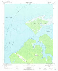
1953 · East Lake
USGS Topo · 1:24,000

1953 · Engelhard NE
USGS Topo · 1:24,000

1953 · Frying Pan
USGS Topo · 1:24,000