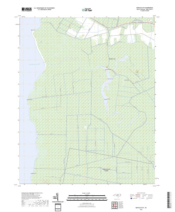
2022 Map of Buffalo City
USGS Topo · Published 2022About this map
Buffalo City is the primary settlement on this mainland Dare County landscape, situated near the headwaters of the winding Long Stretch waterway. The region is defined by its complex network of swampy terrain and small inlets along the inland sound, characterized by numerous points such as Buzzard Roost, Raccoon Point, and Halfway Point. The map illustrates a transitional landscape where the land meets the Atlantic Ocean at Bay Point and Cypress Point.
Find a feature on this map
52 named features on this map. Tap any name to fly to it.
Don’t see what you’re looking for? This feature index may not catch every label — zoom into the map to look around manually.
Map Details
Editions of this 2022 Buffalo City Map
This is the sole edition of this map. No revisions or reprints were ever made.
Other maps of this area

1943 · Columbia
USGS Topo · 1:125,000

1943 · Roanoke Island
USGS Topo · 1:125,000

1953 · Engelhard NW
USGS Topo · 1:24,000

1953 · Buffalo City
USGS Topo · 1:24,000

1953 · Fairfield NE
USGS Topo · 1:24,000

1953 · East Lake SE
USGS Topo · 1:24,000

1953 · Manns Harbor
USGS Topo · 1:24,000
1953 · East Lake
USGS Topo · 1:24,000

1953 · Engelhard NE
USGS Topo · 1:24,000

1953 · Frying Pan
USGS Topo · 1:24,000