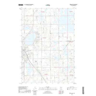
2019 Map of Buffalo East
USGS Topo · Published 2019About this map
The growing town of Buffalo and the nearby community of St. Michael anchor this landscape, where residential development meets a network of glacial lakes and wetlands. Local history and genealogy researchers will find several well-defined burial grounds across the terrain, including Lakeview Cem, Mission Cem, and Zion Cem in the southwest, while Saint Marks Cem and Immanuel Cem serve the eastern township areas. The Buffalo Municipal Airport sits centrally, reflecting the modern infrastructure that connects these Wright County communities.
Find a feature on this map
45 named features on this map. Tap any name to fly to it.
Don’t see what you’re looking for? This feature index may not catch every label — zoom into the map to look around manually.
Map Details
Editions of this 2019 Buffalo East Map
This is the sole edition of this map. No revisions or reprints were ever made.
Other maps of this area

1909 · Rockford
USGS Topo · 1:62,500

1953 · Stillwater
USGS Topo · 1:250,000

1955 · Stillwater
USGS Topo · 1:250,000

1958 · Stillwater
USGS Topo · 1:250,000

1958 · Rockford
USGS Topo · 1:62,500

1958 · Buffalo
USGS Topo · 1:62,500

1961 · Big Lake
USGS Topo · 1:24,000

1961 · Silver Creek
USGS Topo · 1:24,000

1961 · Monticello
USGS Topo · 1:24,000

1961 · Monticello
USGS Topo · 1:62,500