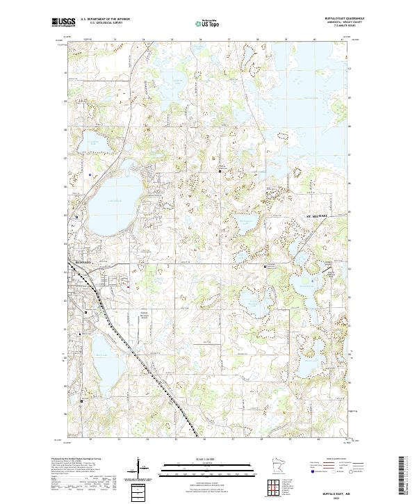
2022 Map of Buffalo East
USGS Topo · Published 2022About this map
The city of Buffalo and the neighboring community of St. Michael define the landscape of this eastern Wright County survey, situated amidst a dense network of glacial lakes and wetlands. The geography is dominated by major water bodies such as Lake Pulaski and the expansive Pelican Lake, with smaller basins like Washington Lake and Pohl Lake interspersed throughout the township grids. Aviation history and local transit are prominent, marked by the Buffalo Municipal Airport and the specialized Greseth Seaplane Base on Schmidt Lake.
Find a feature on this map
63 named features on this map. Tap any name to fly to it.
Don’t see what you’re looking for? This feature index may not catch every label — zoom into the map to look around manually.
Map Details
Editions of this 2022 Buffalo East Map
This is the sole edition of this map. No revisions or reprints were ever made.
Other maps of this area

1909 · Rockford
USGS Topo · 1:62,500

1953 · Stillwater
USGS Topo · 1:250,000

1955 · Stillwater
USGS Topo · 1:250,000

1958 · Stillwater
USGS Topo · 1:250,000

1958 · Rockford
USGS Topo · 1:62,500

1958 · Buffalo
USGS Topo · 1:62,500

1961 · Big Lake
USGS Topo · 1:24,000

1961 · Silver Creek
USGS Topo · 1:24,000

1961 · Monticello
USGS Topo · 1:24,000

1961 · Monticello
USGS Topo · 1:62,500