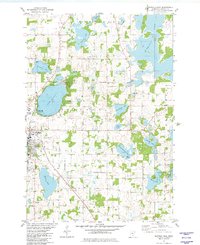
1981 Map of Buffalo East
USGS Topo · Published 1982About this map
The city of Buffalo serves as the focal point of this Wright County landscape, shown here at the start of the 1980s. The area is defined by its glacial hydrology, with significant water bodies like the large Lake Pulaski and Pelican Lake surrounded by a dense network of smaller basins, including Paradise Lake, Washington Lake, and Lake Charlotte. The Soo Line railroad cuts diagonally through the terrain, passing near Mary Lake and the Buffalo Municipal Airport, reflecting the region's transport infrastructure.
Find a feature on this map
40 named features on this map. Tap any name to fly to it.
Don’t see what you’re looking for? This feature index may not catch every label — zoom into the map to look around manually.
Map Details
Editions of this 1981 Buffalo East Map
This is the sole edition of this map. No revisions or reprints were ever made.
Other maps of this area

1909 · Rockford
USGS Topo · 1:62,500

1953 · Stillwater
USGS Topo · 1:250,000

1955 · Stillwater
USGS Topo · 1:250,000

1958 · Stillwater
USGS Topo · 1:250,000

1958 · Rockford
USGS Topo · 1:62,500

1958 · Buffalo
USGS Topo · 1:62,500

1961 · Big Lake
USGS Topo · 1:24,000

1961 · Silver Creek
USGS Topo · 1:24,000

1961 · Monticello
USGS Topo · 1:24,000

1961 · Monticello
USGS Topo · 1:62,500