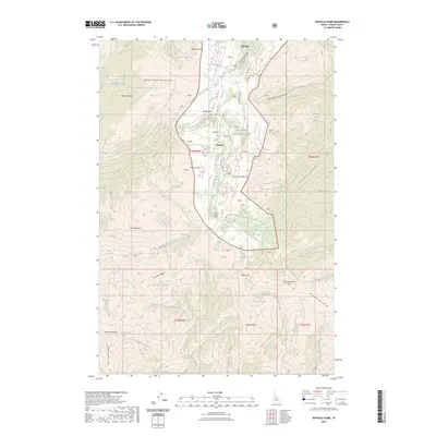
2023 Map of Buffalo Hump
USGS Topo · Published 2023About this map
Concord serves as a lone central point of settlement in this high-altitude landscape dominated by the peaks of the Clearwater Mountains. The prominence of Buffalo Hump and Mineral Hill defines the central topography, surrounded by a high density of alpine lakes such as Mirror Lake, Crescent Lake, and the remote Shining Lake. The terrain is deeply incised by drainages like Calendar Canyon and Whistling Pig Canyon, reflecting a wilderness character preserved within the Gospel-Hump Wilderness and the Nez Perce National Forest. The map details a complex network of ridges, including Quartzite Ridge and Arlington Ridge, which separate the various forks of Sheep Creek and Bull Creek. This 2023 survey documents the enduring physical landmarks of Idaho County, from the high flats of Tepee Flats to the sharp descent of Drumlummen Ridge.
Find a feature on this map
56 named features on this map. Tap any name to fly to it.
Don’t see what you’re looking for? This feature index may not catch every label — zoom into the map to look around manually.
Map Details
Editions of this 2023 Buffalo Hump Map
This is the sole edition of this map. No revisions or reprints were ever made.
Other maps of this area

1931 · Buffalo Hump
USGS Topo · 1:125,000

1934 · Buffalo Hump
USGS Topo · 1:125,000

1956 · Burgdorf
USGS Topo · 1:62,500

1956 · Warren
USGS Topo · 1:62,500

1956 · Elk City
USGS Topo · 1:250,000

1960 · Elk City
USGS Topo · 1:250,000

1963 · Sourdough Peak
USGS Topo · 1:24,000

1963 · Marble Butte
USGS Topo · 1:24,000

1977 · Silver Spur Ridge
USGS Topo · 1:24,000

1979 · Buffalo Hump
USGS Topo · 1:24,000