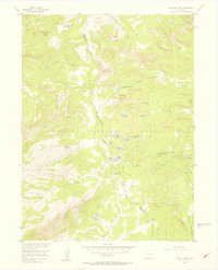
1955 Map of Buffalo Pass
USGS Topo · Published 1956About this map
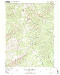
The Continental Divide crests along the Park Range in this mid-century topographic study of the border between Jackson and Routt Counties. This high-altitude landscape within the Routt National Forest is defined by its complex hydrology and primitive transit routes. Several notable alpine basins and parks, such as Horse Thief Park and Newcomb Park, are mapped alongside a high density of glacial lakes, including Lake Dinosaur, Jonah Lake, and Whale Lake. The map details the remote infrastructure of the era, specifically the Summit Lake Guard Sta located near Buffalo Pass. Movement through these peaks was largely restricted to established footpaths like the Wyoming Trail and Newcomb Trail, which navigate the steep drainage divides of South Fork Mad Creek and Fish Creek.
Find a feature on this map
40 named features on this map. Tap any name to fly to it.
Don’t see what you’re looking for? This feature index may not catch every label — zoom into the map to look around manually.
Map Details
Editions of this 1955 Buffalo Pass Map
6 editions found
Other maps of this area

1911 · Hahns Peak
USGS Topo · 1:125,000

1913 · Hahns Peak
USGS Topo · 1:125,000

1954 · Craig
USGS Topo · 1:250,000

1955 · Buffalo Pass
USGS Topo · 1:24,000

1955 · Pitchpine Mountain
USGS Topo · 1:24,000

1955 · Mount Ethel
USGS Topo · 1:24,000

1955 · Teal Lake
USGS Topo · 1:24,000

1955 · Mount Ethel
USGS Topo · 1:62,500

1956 · Rabbit Ears Peak
USGS Topo · 1:24,000

1956 · Storm Mountain
USGS Topo · 1:24,000