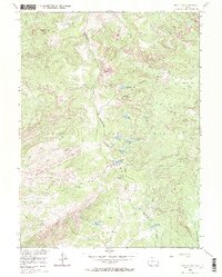
1955 Map of Buffalo Pass
USGS Topo · Published 1970About this map
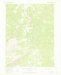
The Continental Divide serves as the primary spine of this 1955 survey, marking the boundary between the Jackson and Routt county lines. Within the Routt National Forest, the landscape is defined by high-altitude peaks and a dense network of glacial lakes including Summit Lake, Lake Dinosaur, and Round Mountain Lake. The central crossing at Buffalo Pass is a focal point for backcountry travel, where the Wyoming Trail and Newcomb Trail converge. Historical indicators of forest management and early recreation are visible through features like the Summit Lake Guard Station. The drainage patterns are clearly delineated, with Soda Creek and Fish Creek flowing westward from the divide, while Newcomb Creek and Whalen Creek trend toward the eastern slopes, illustrating the hydrological significance of the Park Range.
Find a feature on this map
42 named features on this map. Tap any name to fly to it.
Don’t see what you’re looking for? This feature index may not catch every label — zoom into the map to look around manually.
Map Details
Editions of this 1955 Buffalo Pass Map
6 editions found
Other maps of this area

1911 · Hahns Peak
USGS Topo · 1:125,000

1913 · Hahns Peak
USGS Topo · 1:125,000

1954 · Craig
USGS Topo · 1:250,000

1955 · Buffalo Pass
USGS Topo · 1:24,000

1955 · Pitchpine Mountain
USGS Topo · 1:24,000

1955 · Mount Ethel
USGS Topo · 1:24,000

1955 · Teal Lake
USGS Topo · 1:24,000

1955 · Mount Ethel
USGS Topo · 1:62,500

1956 · Rabbit Ears Peak
USGS Topo · 1:24,000

1956 · Storm Mountain
USGS Topo · 1:24,000