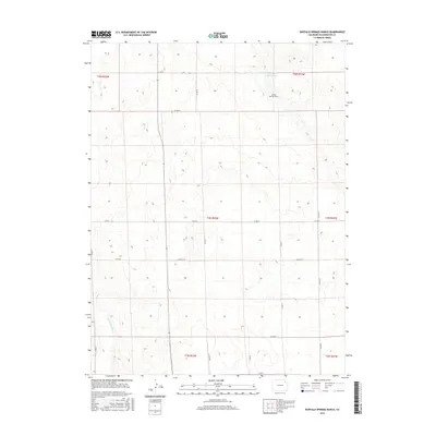
2016 Map of Buffalo Springs Ranch
USGS Topo · Published 2016About this map
Buffalo Springs Ranch serves as a central landmark in this high plains landscape of Washington County, where the topography is defined by the drainage patterns of the Buffalo Cr Reservoir and the Twentytwo Slough. This 2016 survey illustrates a traditional Western grid of township and range boundaries, underscored by a network of rural routes such as Co Rd 55 and Co Rd CC. The placement of the ranch near the reservoir suggests the importance of water management in this arid cattle-country environment. The land is neatly partitioned into sections, with the county road system following these survey lines to connect various ranching operations across the northeastern Colorado plains.
Find a feature on this map
21 named features on this map. Tap any name to fly to it.
Don’t see what you’re looking for? This feature index may not catch every label — zoom into the map to look around manually.
Map Details
Editions of this 2016 Buffalo Springs Ranch Map
This is the sole edition of this map. No revisions or reprints were ever made.
Other maps of this area

1951 · Merino SE
USGS Topo · 1:24,000

1951 · Merino
USGS Topo · 1:24,000

1954 · Sterling
USGS Topo · 1:250,000

1958 · Sterling
USGS Topo · 1:250,000

1971 · Merino
USGS Topo · 1:24,000

1973 · Akron
USGS Topo · 1:24,000

1973 · Buffalo Springs Ranch NW
USGS Topo · 1:24,000

1973 · Platner
USGS Topo · 1:24,000

1973 · Buffalo Springs Ranch NE
USGS Topo · 1:24,000

1973 · Fremont Butte
USGS Topo · 1:24,000