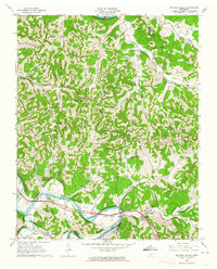
1962 Map of Buffalo Valley
USGS Topo · Published 1964About this map
Caney Fork cuts a deep, winding path through this portion of middle Tennessee, where the Tennessee Central railroad follows the river's northern bank. The landscape is defined by tight ridges and narrow hollows, with small settlements like Chestnut Mound and Buffalo Valley serving as local anchors. Life in this era centered on the river and rail connection, with clear evidence of established family roots in the numerous upland graveyards, including Cowan Cem and Beckman Cem.
Find a feature on this map
75 named features on this map. Tap any name to fly to it.
Don’t see what you’re looking for? This feature index may not catch every label — zoom into the map to look around manually.
Map Details
Editions of this 1962 Buffalo Valley Map
3 editions found
Other maps of this area

1925 · Gainesboro
USGS Topo · 1:62,500

1928 · Gordonsville
USGS Topo · 1:62,500

1929 · Gainesboro
USGS Topo · 1:62,500

1932 · Carthage
USGS Topo · 1:62,500

1942 · Statesville
USGS Topo · 1:100,000

1943 · Cookeville
USGS Topo · 1:100,000

1944 · Cookeville
USGS Topo · 1:100,000

1955 · Baxter
USGS Topo · 1:24,000

1956 · Silver Point
USGS Topo · 1:24,000

1956 · Corbin
USGS Topo · 1:250,000