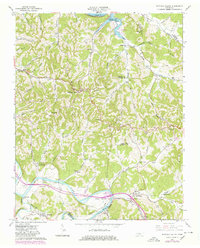
1962 Map of Buffalo Valley
USGS Topo · Published 1980About this map
The Caney Fork and Cumberland River define this topographic survey of the Tennessee interior, where three counties—Smith, Putnam, and De Kalb—intersect. The landscape is marked by the sharp topography of the Highland Rim, deeply incised by hollows like Condit Hollow and Alligier Hollow. Settlement is clustered around the small communities of Chestnut Mound, Buffalo Valley, and Lancaster, each connected by a network of winding roads and the Louisville and Nashville railroad tracks. The map records several small country institutions including New Macedonia Ch, Forks River Sch, and Lancaster Sch. This 1980 revision documents significant changes to the hydrology, specifically the creation of the Cordell Hull Reservoir along the northern edge, showing where the rising waters of the Cumberland River reshaped the valley floor.
Find a feature on this map
73 named features on this map. Tap any name to fly to it.
Don’t see what you’re looking for? This feature index may not catch every label — zoom into the map to look around manually.
Map Details
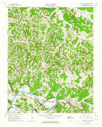
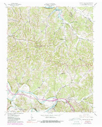
Editions of this 1962 Buffalo Valley Map
3 editions found
Other maps of this area

1925 · Gainesboro
USGS Topo · 1:62,500

1928 · Gordonsville
USGS Topo · 1:62,500

1929 · Gainesboro
USGS Topo · 1:62,500

1932 · Carthage
USGS Topo · 1:62,500

1942 · Statesville
USGS Topo · 1:100,000

1943 · Cookeville
USGS Topo · 1:100,000

1944 · Cookeville
USGS Topo · 1:100,000

1955 · Baxter
USGS Topo · 1:24,000

1956 · Silver Point
USGS Topo · 1:24,000

1956 · Corbin
USGS Topo · 1:250,000