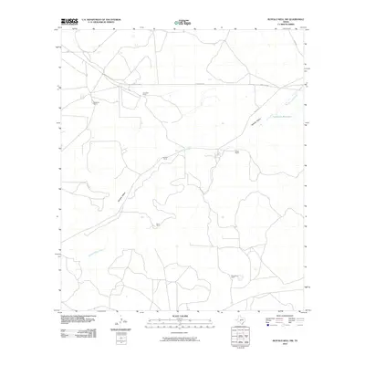
2010 Map of Buffalo Well NW
USGS Topo · Published 2010About this map
Middle Valley and its drainage network, including the Middle Valley Prong, define this ranching landscape in the western reaches of the Edwards Plateau. The map reveals a settlement pattern dictated by water and large-scale landholdings, where individual family legacy is etched into the terrain through named sites like the Mcintosh Ranch, Copeland Ranch, and Schwiening Ranch. A rare named water source, Twentymile Waterhole, sits in the eastern portion of the quadrangle, highlighting the scarcity of surface water in this arid region. Transportation is sparse, anchored by Ranch Rd 2596 and local tracks like Co Rd 245, which connect these dispersed homesteads across the valley floor.
Find a feature on this map
12 named features on this map. Tap any name to fly to it.
Don’t see what you’re looking for? This feature index may not catch every label — zoom into the map to look around manually.
Map Details
Editions of this 2010 Buffalo Well NW Map
This is the sole edition of this map. No revisions or reprints were ever made.
Other maps of this area

1893 · Fort McKavett
USGS Topo · 1:125,000

1954 · Sonora
USGS Topo · 1:250,000

1958 · Sonora
USGS Topo · 1:250,000

1963 · Buffalo Well
USGS Topo · 1:24,000

1963 · Buffalo Well NW
USGS Topo · 1:24,000

1963 · Buffalo Well SE
USGS Topo · 1:24,000

1963 · Adams SE
USGS Topo · 1:24,000

1963 · Buffalo Well SW
USGS Topo · 1:24,000

1963 · Adams SW
USGS Topo · 1:24,000

1964 · Sonora SE
USGS Topo · 1:24,000