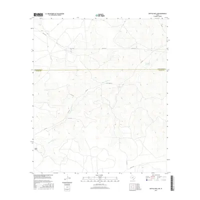
2016 Map of Buffalo Well NW
USGS Topo · Published 2016About this map
Middle Valley defines this portion of the Edwards Plateau, where the drainage of the Middle Valley Prong cuts through the high rangeland of West Texas. This 2016 survey highlights a landscape dominated by large ranching tracts and a sparse network of county and private roads, such as Co Rd 202 and Pvt Rd 2245. A notable historical corridor, the Old Ft Mckavett Rd, traverses the central part of the sheet, providing a link to the region's military and frontier past. The boundary between Schleicher Co and Sutton Co bisects the area, illustrating the administrative divisions of this thinly populated ranch country. Water sources are critical in this arid environment, marked by features like the Twentymile Waterhole, which serve as vital landmarks for local land management and navigation across the plateau.
Find a feature on this map
13 named features on this map. Tap any name to fly to it.
Don’t see what you’re looking for? This feature index may not catch every label — zoom into the map to look around manually.
Map Details
Editions of this 2016 Buffalo Well NW Map
This is the sole edition of this map. No revisions or reprints were ever made.
Other maps of this area

1893 · Fort McKavett
USGS Topo · 1:125,000

1954 · Sonora
USGS Topo · 1:250,000

1958 · Sonora
USGS Topo · 1:250,000

1963 · Buffalo Well
USGS Topo · 1:24,000

1963 · Buffalo Well NW
USGS Topo · 1:24,000

1963 · Buffalo Well SE
USGS Topo · 1:24,000

1963 · Adams SE
USGS Topo · 1:24,000

1963 · Buffalo Well SW
USGS Topo · 1:24,000

1963 · Adams SW
USGS Topo · 1:24,000

1964 · Sonora SE
USGS Topo · 1:24,000