
1963 Map of Buffalo Well
USGS Topo · Published 1965About this map
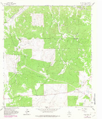
Schleicher and Sutton counties meet along an Indefinite Boundary on this mid-century survey of the Edwards Plateau. The landscape is defined by the ephemeral drainage of Middle Valley Prong, which carves through the Middle Valley before joining the larger topography of Bull Hollow and Buffalo Draw. Human activity in this arid region is tied closely to the energy and ranching sectors, as evidenced by the Wardlaw Ranch and the cluster of industrial infrastructure at Humble Camp. The presence of numerous Gravel Pits, Gas Wells, and a dedicated Landing Strip suggests a period of active resource extraction. Essential utility features including a Pumping Sta, a Radio Tower, and several Pipelines trace the development of the infrastructure supporting these isolated outposts.
Find a feature on this map
19 named features on this map. Tap any name to fly to it.
Don’t see what you’re looking for? This feature index may not catch every label — zoom into the map to look around manually.
Map Details
Editions of this 1963 Buffalo Well Map
2 editions found
Other maps of this area

1893 · Fort McKavett
USGS Topo · 1:125,000

1954 · Sonora
USGS Topo · 1:250,000

1958 · Sonora
USGS Topo · 1:250,000

1963 · Buffalo Well NW
USGS Topo · 1:24,000

1963 · Buffalo Well SE
USGS Topo · 1:24,000

1963 · Adams SE
USGS Topo · 1:24,000
1963 · Brokeleg Mountain
USGS Topo · 1:24,000

1963 · Buffalo Well SW
USGS Topo · 1:24,000

1963 · Adams SW
USGS Topo · 1:24,000
1963 · Coal Kiln Draw
USGS Topo · 1:24,000