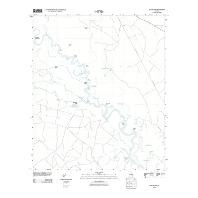
2011 Map of Bug Island
USGS Topo · Published 2011About this map
The Altamaha River winds through a complex network of wetlands and riverine features in this 2011 survey of the coastal plain. The landscape is defined by its water-carved geography, featuring named oxbows and islands such as Bug Island and Joyner Island. Riverside access points like Oxlot Landing, Upper Sansavilla Landing, and Old Landing indicate the ongoing importance of the river for local transit and recreation. Inland, the small community of Paradise Park sits near Yeomans Lake, while several roads including Old Barrington Rd and River Rd provide passage through the wooded terrain.
Find a feature on this map
54 named features on this map. Tap any name to fly to it.
Don’t see what you’re looking for? This feature index may not catch every label — zoom into the map to look around manually.
Map Details
Editions of this 2011 Bug Island Map
This is the sole edition of this map. No revisions or reprints were ever made.
Other maps of this area

1918 · Jesup
USGS Topo · 1:62,500

1918 · Hortense
USGS Topo · 1:62,500

1918 · Everett City
USGS Topo · 1:62,500

1920 · Everett City
USGS Topo · 1:62,500

1943 · Ludowici
USGS Topo · 1:62,500

1943 · Jesup
USGS Topo · 1:62,500

1944 · Everett City
USGS Topo · 1:62,500

1944 · Hortense
USGS Topo · 1:62,500

1946 · Brunswick
USGS Topo · 1:250,000

1948 · Brunswick
USGS Topo · 1:250,000