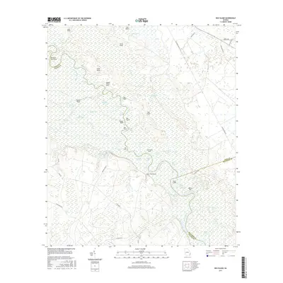
2017 Map of Bug Island
USGS Topo · Published 2017About this map
The Altamaha River winds through a complex network of wetlands and riverine features at the intersection of Long, Wayne, and McIntosh counties. This 2017 survey reveals the intricate hydrology of the Georgia lowlands, where the main channel is flanked by numerous oxbows and sloughs such as Old Hell Lake, Bug Suck Lake, and Steamboat Old River Slough. The landscape is dominated by dense environments like Penholloway Swamp and Gardi Swamp, punctuated by higher ground at Double Yellow Bluff and Bug Bluff. Local navigation and land use are marked by specific river reaches and drifts, including John Lane Drift and Sister Pine Drift. Inland, the road network including Paradise Park Rd and Lord Cemetery Rd serves the rural properties and timberlands bordering the river's extensive floodplain.
Find a feature on this map
66 named features on this map. Tap any name to fly to it.
Don’t see what you’re looking for? This feature index may not catch every label — zoom into the map to look around manually.
Map Details
Editions of this 2017 Bug Island Map
This is the sole edition of this map. No revisions or reprints were ever made.
Other maps of this area

1918 · Jesup
USGS Topo · 1:62,500

1918 · Hortense
USGS Topo · 1:62,500

1918 · Everett City
USGS Topo · 1:62,500

1920 · Everett City
USGS Topo · 1:62,500

1943 · Ludowici
USGS Topo · 1:62,500

1943 · Jesup
USGS Topo · 1:62,500

1944 · Everett City
USGS Topo · 1:62,500

1944 · Hortense
USGS Topo · 1:62,500

1946 · Brunswick
USGS Topo · 1:250,000

1948 · Brunswick
USGS Topo · 1:250,000