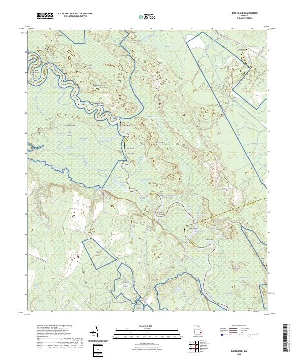
2024 Map of Bug Island
USGS Topo · Published 2024About this map
The Altamaha River carves a complex, winding path through this corner of the Georgia coastal plain, defining the boundaries between Long, Wayne, and McIntosh counties. This riverine landscape is dominated by dense wetlands and seasonal water bodies, including Gardi Swamp and Penholoway Swamp. The intricate hydrology of the area is reflected in numerous oxbow lakes and named river features such as Old Hell Bight, Bug Suck Lake, and the curiously named Sturgeon Hole.
Find a feature on this map
71 named features on this map. Tap any name to fly to it.
Don’t see what you’re looking for? This feature index may not catch every label — zoom into the map to look around manually.
Map Details
Editions of this 2024 Bug Island Map
This is the sole edition of this map. No revisions or reprints were ever made.
Other maps of this area

1918 · Jesup
USGS Topo · 1:62,500

1918 · Hortense
USGS Topo · 1:62,500

1918 · Everett City
USGS Topo · 1:62,500

1920 · Everett City
USGS Topo · 1:62,500

1943 · Ludowici
USGS Topo · 1:62,500

1943 · Jesup
USGS Topo · 1:62,500

1944 · Everett City
USGS Topo · 1:62,500

1944 · Hortense
USGS Topo · 1:62,500

1946 · Brunswick
USGS Topo · 1:250,000

1948 · Brunswick
USGS Topo · 1:250,000