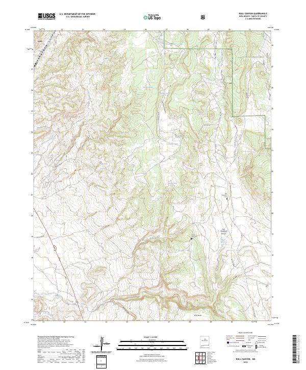
2023 Map of Bull Canyon
USGS Topo · Published 2023About this map
Lamy sits at the northwestern edge of this landscape, where the seasonal waters of Galisteo Creek wind through the high desert terrain. The area is defined by a network of drainage systems and canyons, most notably Bull Canyon and Bobcat Canyon, which carve through the high plateaus of Pine Mesa. The presence of the Santa Fe National Forest in the northeast highlights the transition from open grazing land to protected woodlands.
Find a feature on this map
38 named features on this map. Tap any name to fly to it.
Don’t see what you’re looking for? This feature index may not catch every label — zoom into the map to look around manually.
Map Details
Editions of this 2023 Bull Canyon Map
This is the sole edition of this map. No revisions or reprints were ever made.
Other maps of this area

1889 · Santa Fe
USGS Topo · 1:125,000

1894 · Santa Fe
USGS Topo · 1:125,000

1894 · Lamy
USGS Topo · 1:125,000

1952 · Seton Village
USGS Topo · 1:24,000

1953 · Glorieta
USGS Topo · 1:24,000

1954 · Santa Fe
USGS Topo · 1:250,000

1958 · Santa Fe
USGS Topo · 1:250,000
1961 · Pecos
USGS Topo · 1:24,000
1966 · Ojo Hedionda
USGS Topo · 1:24,000
1966 · Galisteo
USGS Topo · 1:24,000