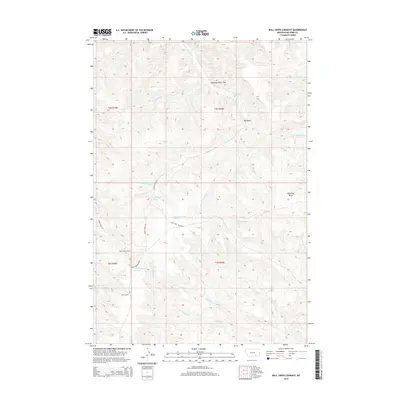
2014 Map of Bull Creek Lookout
USGS Topo · Published 2014About this map
Bull Creek Lookout anchors this terrain in Big Horn County, Montana, overlooking a complex drainage network where the high country meets the basin floor. The geography is defined by a series of critical water sources, including Killsnight Spring and Hardrobe Spring, which have long served as vital landmarks in this arid landscape. The map reveals a remote pastoral and ranching environment, structured by significant natural features like the Hardrobe Water Gap and the wide Wild Hog Basin. Local transportation is limited to established routes such as Muddy Creek Rd and Trail Creek Rd, which trace the valleys of W Fork Muddy Cr and other tributaries. The naming of landmarks like Big Bend on the creek and various springs suggests a landscape where specific points of relief and water are the primary organizers of human activity and navigation.
Find a feature on this map
26 named features on this map. Tap any name to fly to it.
Don’t see what you’re looking for? This feature index may not catch every label — zoom into the map to look around manually.
Map Details
Editions of this 2014 Bull Creek Lookout Map
This is the sole edition of this map. No revisions or reprints were ever made.
Other maps of this area

1954 · Hardin
USGS Topo · 1:250,000

1957 · Hardin
USGS Topo · 1:250,000

1958 · Hardin
USGS Topo · 1:250,000

1958 · Painted Hill
USGS Topo · 1:24,000

1958 · Bull Creek Lookout
USGS Topo · 1:24,000

1958 · Busby
USGS Topo · 1:24,000

1958 · Birdseye Spring
USGS Topo · 1:24,000

1958 · Lame Deer
USGS Topo · 1:24,000
1967 · Cook Creek Butte
USGS Topo · 1:24,000

1967 · Kirby
USGS Topo · 1:24,000