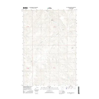
2017 Map of Bull Creek Lookout
USGS Topo · Published 2017About this map
Bull Creek Lookout anchors the southwest quadrant of this high-plains landscape in Big Horn County, where the terrain is defined by a dense network of seasonal drainages and named springs. The hydrology here is complex, with the Hardrobe Cr and W Fork Muddy Cr flowing toward the Hardrobe Water Gap in the north, while the southern half of the sheet is dominated by the branching headwaters of S Fork Bull Cr and Middle Fork Bull Cr.
Find a feature on this map
25 named features on this map. Tap any name to fly to it.
Don’t see what you’re looking for? This feature index may not catch every label — zoom into the map to look around manually.
Map Details
Editions of this 2017 Bull Creek Lookout Map
This is the sole edition of this map. No revisions or reprints were ever made.
Other maps of this area

1954 · Hardin
USGS Topo · 1:250,000

1957 · Hardin
USGS Topo · 1:250,000

1958 · Hardin
USGS Topo · 1:250,000

1958 · Painted Hill
USGS Topo · 1:24,000

1958 · Bull Creek Lookout
USGS Topo · 1:24,000

1958 · Busby
USGS Topo · 1:24,000

1958 · Birdseye Spring
USGS Topo · 1:24,000

1958 · Lame Deer
USGS Topo · 1:24,000
1967 · Cook Creek Butte
USGS Topo · 1:24,000

1967 · Kirby
USGS Topo · 1:24,000