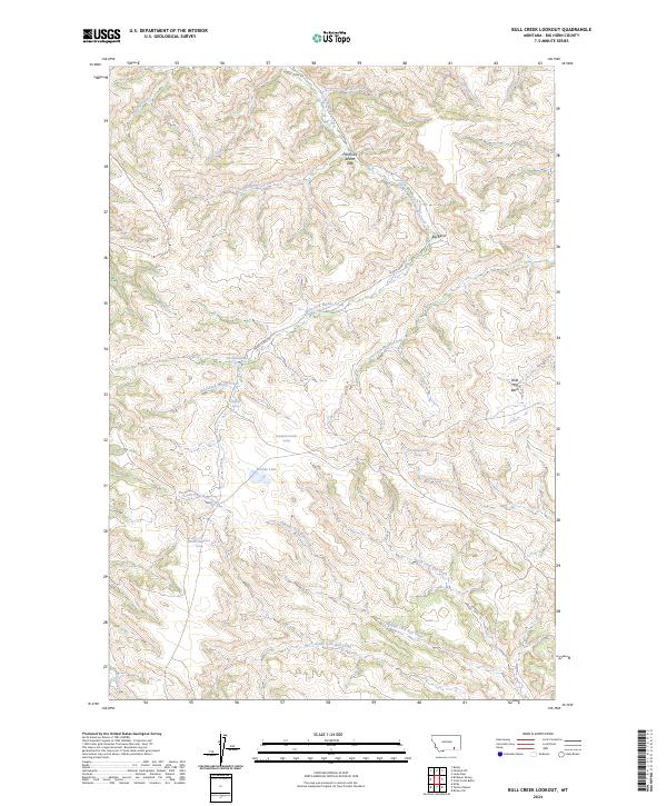
2024 Map of Bull Creek Lookout
USGS Topo · Published 2024About this map
Hardrobe Water Gap serves as a prominent landmark in this segment of Big Horn County, where the landscape is defined by the intricate drainage systems of Muddy Creek and South Fork Bull Creek. The terrain is characterized by a dense network of coulees and ridges, with water sources like Killnight Spring and Muddy Lake providing critical points of reference in an otherwise arid environment. Evidence of the area's geography is further seen at the Big Bend of Muddy Creek and the secluded Wild Hog Basin.
Find a feature on this map
30 named features on this map. Tap any name to fly to it.
Don’t see what you’re looking for? This feature index may not catch every label — zoom into the map to look around manually.
Map Details
Editions of this 2024 Bull Creek Lookout Map
This is the sole edition of this map. No revisions or reprints were ever made.
Other maps of this area

1954 · Hardin
USGS Topo · 1:250,000

1957 · Hardin
USGS Topo · 1:250,000

1958 · Hardin
USGS Topo · 1:250,000

1958 · Painted Hill
USGS Topo · 1:24,000

1958 · Bull Creek Lookout
USGS Topo · 1:24,000

1958 · Busby
USGS Topo · 1:24,000

1958 · Birdseye Spring
USGS Topo · 1:24,000

1958 · Lame Deer
USGS Topo · 1:24,000
1967 · Cook Creek Butte
USGS Topo · 1:24,000

1967 · Kirby
USGS Topo · 1:24,000