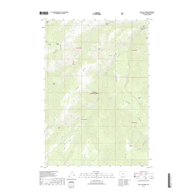
2017 Map of Bull Elk Park
USGS Topo · Published 2017About this map
Bighorn National Forest dominates this landscape, where the Little Bighorn River carves through high country toward the Little Bighorn Valley. The terrain is defined by dramatic elevation changes across several prominent massifs, including Fisher Mtn and Leaky Mtn, separated by deep drainage systems like Halfway Canyon and Dark Canyon. This 2017 survey details the complex network of ridges, such as Boyd Ridge and Dry Fork Ridge, that dictate the movement of water and travelers through the region.
Find a feature on this map
42 named features on this map. Tap any name to fly to it.
Don’t see what you’re looking for? This feature index may not catch every label — zoom into the map to look around manually.
Map Details
Editions of this 2017 Bull Elk Park Map
This is the sole edition of this map. No revisions or reprints were ever made.
Other maps of this area

1894 · St. Xavier
USGS Topo · 1:125,000

1898 · Bald Mountain
USGS Topo · 1:125,000

1901 · St. Xavier
USGS Topo · 1:125,000

1901 · Bald Mountain
USGS Topo · 1:125,000

1954 · Hardin
USGS Topo · 1:250,000

1955 · Sheridan
USGS Topo · 1:250,000

1957 · Hardin
USGS Topo · 1:250,000

1958 · Hardin
USGS Topo · 1:250,000

1958 · Sheridan
USGS Topo · 1:250,000

1960 · Boyd Ridge
USGS Topo · 1:24,000