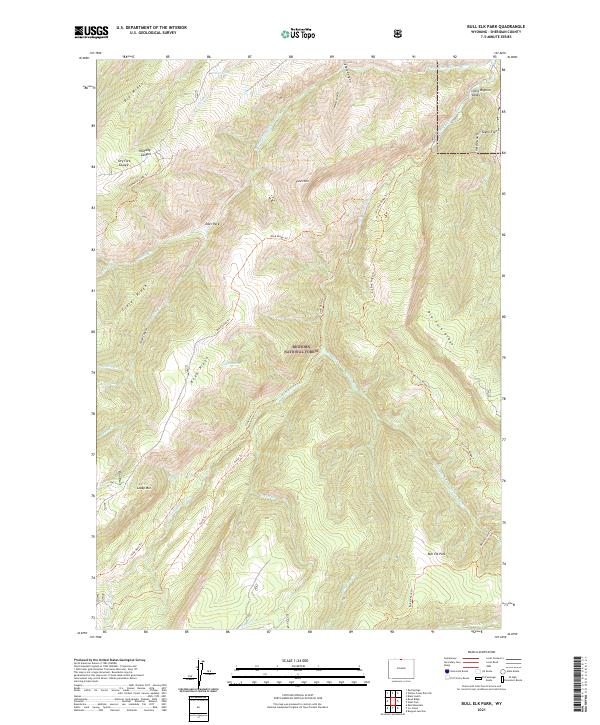
2021 Map of Bull Elk Park
USGS Topo · Published 2021About this map
Bighorn National Forest contains a complex network of high-elevation drainages and ridges centered on the Little Bighorn River. This topographic landscape is defined by the confluence of the W Fork Little Bighorn River and the Dry Fork Little Bighorn River, carving deep paths through the Little Bighorn Valley. The terrain rises from the valley floor to prominent heights like Fisher Mtn and Leaky Mtn, while flatlands such as Taylor Flat and Deer Park offer breaks in the verticality. A detailed system of historic trails, including the Little Horn Trl and Boyd Ridge Trl, suggests a legacy of recreational and administrative access through the backcountry. Near the southern boundary, Bull Elk Park serves as a focal point for the headwaters of Bear Trap Cr and Ice Creek, illustrating the remote wilderness character of Sheridan County's mountain interior.
Find a feature on this map
41 named features on this map. Tap any name to fly to it.
Don’t see what you’re looking for? This feature index may not catch every label — zoom into the map to look around manually.
Map Details
Editions of this 2021 Bull Elk Park Map
This is the sole edition of this map. No revisions or reprints were ever made.
Other maps of this area

1894 · St. Xavier
USGS Topo · 1:125,000

1898 · Bald Mountain
USGS Topo · 1:125,000

1901 · St. Xavier
USGS Topo · 1:125,000

1901 · Bald Mountain
USGS Topo · 1:125,000

1954 · Hardin
USGS Topo · 1:250,000

1955 · Sheridan
USGS Topo · 1:250,000

1957 · Hardin
USGS Topo · 1:250,000

1958 · Hardin
USGS Topo · 1:250,000

1958 · Sheridan
USGS Topo · 1:250,000

1960 · Boyd Ridge
USGS Topo · 1:24,000