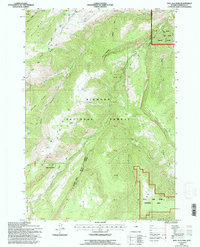
1993 Map of Bull Elk Park
USGS Topo · Published 1997About this map
Bighorn National Forest dominates this high-elevation landscape, where the headwaters of the West Fork Little Bighorn River and Dry Fork Little Bighorn River carve deep drainages through the limestone and dolomite layers of the Bighorn Mountains. The map reveals a land managed for both wildlife and industry, featuring the expansive Kerns Big Game Winter Range alongside markers of resource extraction like the Marble Quarry Road. High ridgelines such as Horse Ridge and Dry Fork Ridge define the local topography, punctuated by isolated sites of human activity including Deer Park and Cow Camp. Within the Medicine Wheel Tongue Ranger District, the Bull Elk Park Natural Area preserves a specific high-plateau ecosystem. The presence of an L A Trail (Abandoned) and scattered water features like Willow Spring and Bear Spring reflect the region's history of livestock grazing and early backcountry transit.
Find a feature on this map
51 named features on this map. Tap any name to fly to it.
Don’t see what you’re looking for? This feature index may not catch every label — zoom into the map to look around manually.
Map Details
Editions of this 1993 Bull Elk Park Map
This is the sole edition of this map. No revisions or reprints were ever made.
Other maps of this area

1894 · St. Xavier
USGS Topo · 1:125,000

1898 · Bald Mountain
USGS Topo · 1:125,000

1901 · St. Xavier
USGS Topo · 1:125,000

1901 · Bald Mountain
USGS Topo · 1:125,000

1954 · Hardin
USGS Topo · 1:250,000

1955 · Sheridan
USGS Topo · 1:250,000

1957 · Hardin
USGS Topo · 1:250,000

1958 · Hardin
USGS Topo · 1:250,000

1958 · Sheridan
USGS Topo · 1:250,000

1960 · Boyd Ridge
USGS Topo · 1:24,000