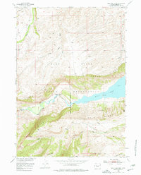
1952 Map of Bull Lake West
USGS Topo · Published 1977About this map
Wind River Indian Reservation lands dominate this high-desert landscape, where the waters of Bull Lake are managed through the Riverton Reclamation Project. The terrain is defined by dramatic elevations like Wind River Ridge and Cedar Ridge, which overlook the complex drainage systems of Bull Lake Creek and North Fork Sage Creek.
Find a feature on this map
22 named features on this map. Tap any name to fly to it.
Don’t see what you’re looking for? This feature index may not catch every label — zoom into the map to look around manually.
Map Details
Editions of this 1952 Bull Lake West Map
4 editions found
Other maps of this area

1951 · Bull Lake East
USGS Topo · 1:24,000

1952 · Wise Flat
USGS Topo · 1:24,000

1952 · Crowheart Butte
USGS Topo · 1:24,000

1952 · Bull Lake West
USGS Topo · 1:24,000

1952 · Crowheart
USGS Topo · 1:24,000

1952 · Burris
USGS Topo · 1:24,000

1952 · Kirkland Park
USGS Topo · 1:24,000

1952 · Paradise Basin
USGS Topo · 1:24,000

1952 · St. Lawrence Basin
USGS Topo · 1:24,000

1955 · Thermopolis
USGS Topo · 1:250,000