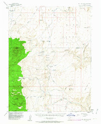
1952 Map of Bull Mountain
USGS Topo · Published 1963About this map
The eastern slopes of the Henry Mountains and the arid expanse of the Burr Desert dominate this 1950s survey of Garfield and Wayne Counties. Published in cooperation with the Atomic Energy Commission, the map reveals a remote landscape of extreme topography, from the high timber of Bull Mountain down to the broken drainages of Crescent Wash and Death Canyon. Ranching activity is documented at the Fairview Ranch, Trachyte Ranch, and the Granite Ranch (Site), suggesting the seasonal movement of livestock through these canyons. Names like Poison Spring Benches, Little Egypt, and Pyserts Hole reflect the colorful local nomenclature of the canyon country, while several unmarked Mine and Prospect symbols hint at the uranium exploration boom that characterized the Colorado Plateau during this era.
Find a feature on this map
50 named features on this map. Tap any name to fly to it.
Don’t see what you’re looking for? This feature index may not catch every label — zoom into the map to look around manually.
Map Details
Editions of this 1952 Bull Mountain Map
4 editions found

Other maps of this area

1885 · San Rafael
USGS Topo · 1:250,000

1886 · Henry Mountains
USGS Topo · 1:250,000

1892 · Henry Mountains
USGS Topo · 1:250,000

1952 · Orange Cliffs 3 SW
USGS Topo · 1:24,000

1952 · Mount Ellen 4 SW
USGS Topo · 1:24,000

1952 · Mt Pennell 2 NE
USGS Topo · 1:24,000

1952 · Mt Pennell 1 NE
USGS Topo · 1:24,000

1952 · Mt Hillers
USGS Topo · 1:62,500

1952 · Mt. Ellen 4 NW
USGS Topo · 1:24,000

1952 · Mt Pennell 1 NW
USGS Topo · 1:24,000