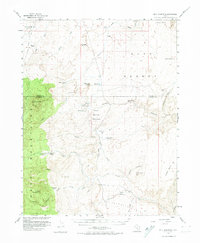
1952 Map of Bull Mountain
USGS Topo · Published 1974About this map
Bull Mountain and the eastern flanks of the Henry Mountains dominate this early 1950s landscape, a region defined by high desert terrain and isolated outposts. The survey shows a sparsely settled territory where life centered on reliable water sources, evidenced by Fairview Ranch and Granite Ranch, along with several engineered catchments such as Goatwater Point Reservoir and Lone Cedar Reservoir. This era of mapping was influenced by regional interest in mineral exploration, noted by the presence of a Mine and a Prospect tucked into the canyons. Geologic and geographic transitions are marked by the wide Burr Desert to the east and the intricate drainage systems of Little Egypt Wash and Poison Spring. Significant landmarks like Adams Butte and Trachyte Point provide navigational anchors across the dry benches and deep canyons of this Garfield County interior.
Find a feature on this map
44 named features on this map. Tap any name to fly to it.
Don’t see what you’re looking for? This feature index may not catch every label — zoom into the map to look around manually.
Map Details
Editions of this 1952 Bull Mountain Map
4 editions found

Other maps of this area

1885 · San Rafael
USGS Topo · 1:250,000

1886 · Henry Mountains
USGS Topo · 1:250,000

1892 · Henry Mountains
USGS Topo · 1:250,000

1952 · Orange Cliffs 3 SW
USGS Topo · 1:24,000

1952 · Mount Ellen 4 SW
USGS Topo · 1:24,000

1952 · Mt Pennell 2 NE
USGS Topo · 1:24,000

1952 · Mt Pennell 1 NE
USGS Topo · 1:24,000

1952 · Mt Hillers
USGS Topo · 1:62,500

1952 · Mt. Ellen 4 NW
USGS Topo · 1:24,000

1952 · Mt Pennell 1 NW
USGS Topo · 1:24,000