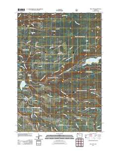
2011 Map of Bull Run
USGS Topo · Published 2011About this map
Bull Run River and the Sandy River converge in this landscape, which serves as a critical corridor for water management and regional recreation. The topography is defined by significant water bodies, including Bull Run Reservoir Number Two and Roslyn Lake, alongside the prominent Devils Backbone ridge. Small communities and rural settlements like Aims and Firwood are connected by a network of local roads such as SE Marmot Rd and SE Coalman Rd. The area supports specialized facilities, including Camp Namanu, Camp Howard, and two private airstrips, McKinnon Enterprises Airfield and Richs Airfield. This 2011 survey captures the area at a transitional moment for local infrastructure, notably showing the Roslyn Lake Picnic Area and the Revenue Bridge before regional decommissioning and changes to the hydraulic systems altered the local geography.
Find a feature on this map
67 named features on this map. Tap any name to fly to it.
Don’t see what you’re looking for? This feature index may not catch every label — zoom into the map to look around manually.
Map Details
Editions of this 2011 Bull Run Map
This is the sole edition of this map. No revisions or reprints were ever made.
Other maps of this area

1911 · Boring
USGS Topo · 1:48,000

1914 · Boring
USGS Topo · 1:62,500

1916 · Estacada
USGS Topo · 1:125,000

1918 · Troutdale
USGS Topo · 1:62,500

1934 · Troutdale
USGS Topo · 1:48,000

1940 · Boring
USGS Topo · 1:62,500

1941 · Camas
USGS Topo · 1:62,500

1942 · Camas
USGS Topo · 1:62,500

1948 · Vancouver
USGS Topo · 1:250,000

1950 · Vancouver
USGS Topo · 1:250,000