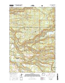
2017 Map of Bull Run
USGS Topo · Published 2017About this map
Sandy serves as the gateway to the western slopes of the Cascades, where the Sandy River and Bull Run River converge in a landscape defined by deep river canyons and timber resources. This area transitions from the developing residential and commercial outskirts of Sandy and Firwood into the managed timberlands and protected watersheds of the Mount Hood National Forest. The presence of the Bull Run Reservoir Number 2 and the Firwood Veneer Corporation Reservoir highlights the critical role this geography plays in regional water management and the wood products industry. Settlement patterns follow the ridge lines and river terraces, with named features like Devils Backbone and Walker Prairie indicating the prominent topographical landmarks used by early travelers and surveyors. Aviation and transport links are evident through the Sandy River Airport, Mc Kinnon Airpark, and the historic crossing at Revenue Bridge.
Find a feature on this map
82 named features on this map. Tap any name to fly to it.
Don’t see what you’re looking for? This feature index may not catch every label — zoom into the map to look around manually.
Map Details
Editions of this 2017 Bull Run Map
This is the sole edition of this map. No revisions or reprints were ever made.
Other maps of this area

1911 · Boring
USGS Topo · 1:48,000

1914 · Boring
USGS Topo · 1:62,500

1916 · Estacada
USGS Topo · 1:125,000

1918 · Troutdale
USGS Topo · 1:62,500

1934 · Troutdale
USGS Topo · 1:48,000

1940 · Boring
USGS Topo · 1:62,500

1941 · Camas
USGS Topo · 1:62,500

1942 · Camas
USGS Topo · 1:62,500

1948 · Vancouver
USGS Topo · 1:250,000

1950 · Vancouver
USGS Topo · 1:250,000