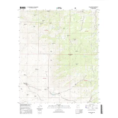
2017 Map of Bullard Peak
USGS Topo · Published 2017About this map
The Big Burro Mountains dominate this high-desert landscape within the Gila National Forest, where a complex network of canyons and peaks creates a demanding environment for water management. The mapping reveals a high density of livestock tanks and springs, such as Bald Knoll Tank, Mine Shaft Spring, and Burro Spring, which are vital for ranching operations like those indicated by the F-Bar Ranch Rd. Modern recreation and historic transit paths intersect here, most notably where the Continental Divide National Scenic Trail winds along the ridgelines near Bullard Peak. The presence of North Copper Canyon and South Copper Canyon suggests a history of mineral exploration, while roads like Edgar Place Rd and Red Rock Rd provide the primary access through the steep drainages of Stein Canyon and Black Hawk Canyon.
Find a feature on this map
56 named features on this map. Tap any name to fly to it.
Don’t see what you’re looking for? This feature index may not catch every label — zoom into the map to look around manually.
Map Details
Editions of this 2017 Bullard Peak Map
This is the sole edition of this map. No revisions or reprints were ever made.
Other maps of this area

1909 · Silver City
USGS Topo · 1:125,000

1949 · Circle Mesa
USGS Topo · 1:24,000

1950 · Wind Mountain
USGS Topo · 1:24,000

1950 · Burro Peak
USGS Topo · 1:24,000

1951 · Circle Mesa
USGS Topo · 1:24,000

1951 · Big Burro Mountains
USGS Topo · 1:24,000

1951 · Wind Mountain
USGS Topo · 1:24,000

1954 · Silver City
USGS Topo · 1:250,000

1958 · Silver City
USGS Topo · 1:250,000

1959 · Redrock
USGS Topo · 1:62,500