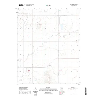
2020 Map of Bulldog Mesa
USGS Topo · Published 2020About this map
Bulldog Mesa rises above the drainage networks of Quay County, defined by the winding paths of Plaza Larga Cr and Apodaca Cr. This landscape is marked by the high-plateau geography of eastern New Mexico, where topographic relief is anchored by the prominent Mesa Redonda in the south. The rural character of the area is evidenced by the systematic grid of local routes like Quay Road 53 and Quay Road AJ, which connect isolated sites of local heritage. Genealogists and historians will find significance in the Newhome Cem and Apodaca Cem, small landmarks that indicate the historical presence of scattered ranching communities. Water management is a visible priority across the terrain, shown through features like the Savage Lateral and several small intermittent streams including Spikes Cr and Garcita Cr.
Find a feature on this map
24 named features on this map. Tap any name to fly to it.
Don’t see what you’re looking for? This feature index may not catch every label — zoom into the map to look around manually.
Map Details
Editions of this 2020 Bulldog Mesa Map
This is the sole edition of this map. No revisions or reprints were ever made.
Other maps of this area

1930 · Tucumcari
USGS Topo · 1:125,000

1954 · Tucumcari
USGS Topo · 1:250,000

1954 · Clovis
USGS Topo · 1:250,000

1958 · Clovis
USGS Topo · 1:250,000

1958 · Tucumcari
USGS Topo · 1:250,000

1967 · Liberty Mesa
USGS Topo · 1:24,000

1967 · Tucumcari
USGS Topo · 1:24,000

1968 · Bulldog Mesa
USGS Topo · 1:24,000

1968 · Lesbia
USGS Topo · 1:24,000
1968 · Briscoe Ranch
USGS Topo · 1:24,000