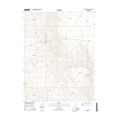
2014 Map of Bullgrass Knoll
USGS Topo · Published 2014About this map
Bullgrass Knoll stands as a prominent topographical feature in this high-desert region of Millard County, situated within the wider expanse of the Confusion Range. The landscape is defined by a series of dramatic limestone and dolomite drainages, including the deep cuts of Kings Canyon and Cat Canyon, which channel toward the open flats of Tule Valley to the northeast. Transportation through this arid corridor is primarily facilitated by Us-50, which winds through the canyon pass near Kings Rd.
Find a feature on this map
20 named features on this map. Tap any name to fly to it.
Don’t see what you’re looking for? This feature index may not catch every label — zoom into the map to look around manually.
Map Details
Editions of this 2014 Bullgrass Knoll Map
This is the sole edition of this map. No revisions or reprints were ever made.
Other maps of this area

1908 · Fish Springs
USGS Topo · 1:250,000

1910 · Fish Springs
USGS Topo · 1:250,000

1953 · Richfield
USGS Topo · 1:250,000

1953 · Delta
USGS Topo · 1:250,000

1958 · Richfield
USGS Topo · 1:250,000

1958 · Delta
USGS Topo · 1:250,000

1960 · Notch Peak
USGS Topo · 1:62,500

1960 · Crystal Peak
USGS Topo · 1:62,500

1960 · Conger Mountain
USGS Topo · 1:62,500

1960 · The Barn
USGS Topo · 1:62,500