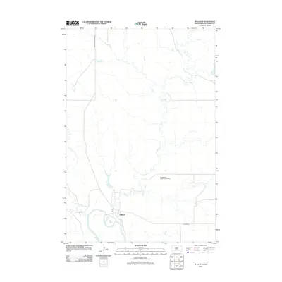
2012 Map of Bullhead
USGS Topo · Published 2012About this map
Bullhead and its surrounding prairie landscape are defined by the winding course of the Grand River and the extensive network of Rock Cr that drains the region. This 2012 survey shows the settlement's small-town grid, including 1st St, 2nd St, and 3rd St, with a centrally located Po serving the community. The area's reliance on local aviation and rural transit is evident through the Cottonwood Ranch Landing Strip and major thoroughfares like Bureau Indian Affairs 16. The topography is shaped by various waterways, including the uniquely named Iron Dog Cr and Stink Cr, which carve through the plains north of W Bullhead Rd.
Find a feature on this map
13 named features on this map. Tap any name to fly to it.
Don’t see what you’re looking for? This feature index may not catch every label — zoom into the map to look around manually.
Map Details
Editions of this 2012 Bullhead Map
This is the sole edition of this map. No revisions or reprints were ever made.
Other maps of this area

1953 · McIntosh
USGS Topo · 1:250,000

1956 · Bullhead
USGS Topo · 1:24,000

1956 · Little Eagle NW
USGS Topo · 1:24,000

1956 · Miscol
USGS Topo · 1:24,000

1956 · Bullhead SW
USGS Topo · 1:24,000

1956 · Miscol NE
USGS Topo · 1:24,000

1958 · McIntosh
USGS Topo · 1:250,000

1971 · McLaughlin SW
USGS Topo · 1:24,000
1971 · Maple Leaf
USGS Topo · 1:24,000

1972 · Walker
USGS Topo · 1:24,000