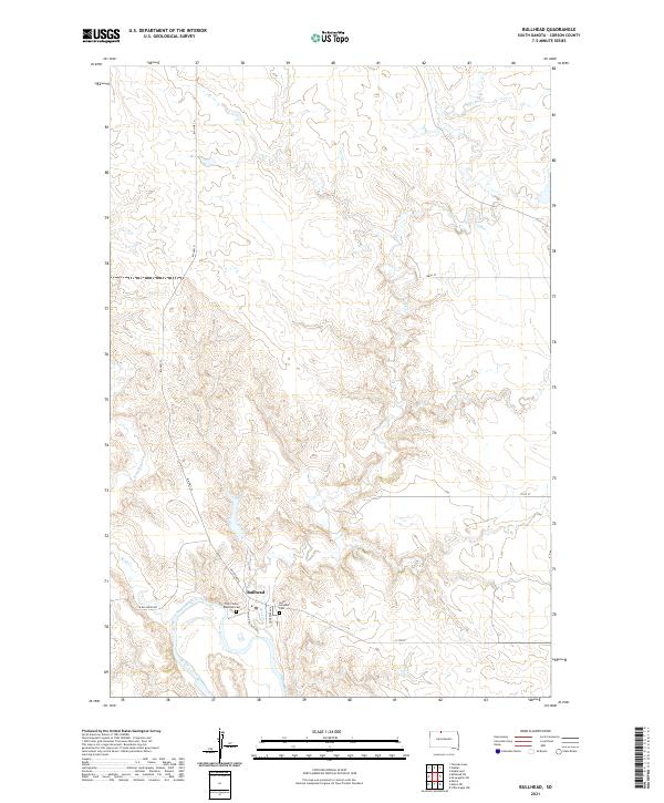
2021 Map of Bullhead
USGS Topo · Published 2021About this map
The Grand River snakes through the southern portion of this landscape, anchoring the settlement of Bullhead. This community is defined by a modest grid of streets, including the evocatively named Rain In The Face Ave and Bullhead Rd. The terrain is deeply etched by a network of drainage systems, most notably Rock Cr, Iron Dog Cr, and Stink Cr, which carve through the high prairie land of Corson County.
Find a feature on this map
19 named features on this map. Tap any name to fly to it.
Don’t see what you’re looking for? This feature index may not catch every label — zoom into the map to look around manually.
Map Details
Editions of this 2021 Bullhead Map
This is the sole edition of this map. No revisions or reprints were ever made.
Other maps of this area

1953 · McIntosh
USGS Topo · 1:250,000

1956 · Bullhead
USGS Topo · 1:24,000

1956 · Little Eagle NW
USGS Topo · 1:24,000

1956 · Miscol
USGS Topo · 1:24,000

1956 · Bullhead SW
USGS Topo · 1:24,000

1956 · Miscol NE
USGS Topo · 1:24,000

1958 · McIntosh
USGS Topo · 1:250,000

1971 · McLaughlin SW
USGS Topo · 1:24,000
1971 · Maple Leaf
USGS Topo · 1:24,000

1972 · Walker
USGS Topo · 1:24,000