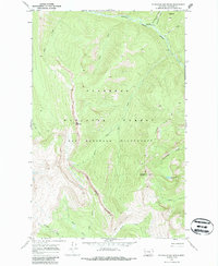
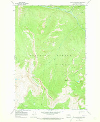
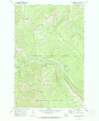
1970 Map of Bungalow Mountain
USGS Topo · Published 1987About this map
The Bob Marshall Wilderness and Flathead National Forest define this 1970 study of remote Montana backcountry. The landscape is shaped by the confluence of the Spotted Bear River and White River, with the Wall Creek Cliffs forming a massive natural barrier along the western edge of the quadrangle. Interior access at this time relied on a primitive network of paths including the White River Trail and the Bungalow Lookout Trail. High peaks like Ibex Mountain and Bungalow Mountain overlook a series of drainages, including Christopher Creek and Rooney Creek. Near the northern border, the Pentagon Guard Sta serves as a lone outpost of federal management in the wilderness, situated near the headwaters of Pentagon Creek and Clack Creek.
Find a feature on this map
26 named features on this map. Tap any name to fly to it.
Don’t see what you’re looking for? This feature index may not catch every label — zoom into the map to look around manually.
Map Details
Editions of this 1970 Bungalow Mountain Map
2 editions found
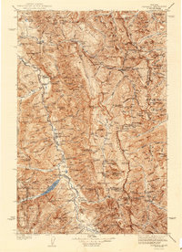
Other maps of this area

1936 · Silvertip
USGS Topo · 1:96,000
1942 · Silvertip
USGS Topo · 1:125,000

1955 · Choteau
USGS Topo · 1:250,000

1957 · Choteau
USGS Topo · 1:250,000

1958 · Choteau
USGS Topo · 1:250,000

1962 · Choteau
USGS Topo · 1:250,000
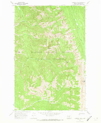
1970 · Cathedral Peak
USGS Topo · 1:24,000
1970 · Whitcomb Peak
USGS Topo · 1:24,000
1970 · Trilobite Peak
USGS Topo · 1:24,000
1970 · Pagoda Mountain
USGS Topo · 1:24,000