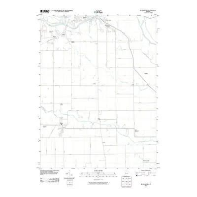
2010 Map of Bunker Hill
USGS Topo · Published 2010About this map
The Wabash River and Mississinewa River define the northern reaches of this Miami County landscape, where the city of Peru and its neighbors South Peru and Park View Heights sit along the water. Moving south, the terrain is characterized by a dense network of agricultural ditches and creeks, including Pipe Creek and Little Pipe Creek, which influenced the placement of early settlements and family burial grounds. The map provides a detailed look at the rural road grid connecting small communities like Bunker Hill, Loree, and McGrawsville. Local history is preserved in the numerous named cemeteries such as Sharpee Cemetery, Crider Cemetery, and Leonda Cemetery that dot the countryside. Aviation interests are also represented by the presence of Weed Field Airport and the uniquely named Shinn Bone Lane Airport near the center of the quadrangle.
Find a feature on this map
57 named features on this map. Tap any name to fly to it.
Don’t see what you’re looking for? This feature index may not catch every label — zoom into the map to look around manually.
Map Details
Editions of this 2010 Bunker Hill Map
This is the sole edition of this map. No revisions or reprints were ever made.
Other maps of this area

1951 · Peru
USGS Topo · 1:24,000

1951 · Onward
USGS Topo · 1:24,000

1951 · Twelve Mile
USGS Topo · 1:24,000

1951 · Bunker Hill
USGS Topo · 1:24,000

1951 · Richvalley
USGS Topo · 1:24,000

1953 · Peoria
USGS Topo · 1:24,000

1953 · Danville
USGS Topo · 1:250,000

1953 · Muncie
USGS Topo · 1:250,000

1955 · Danville
USGS Topo · 1:250,000

1956 · Muncie
USGS Topo · 1:250,000