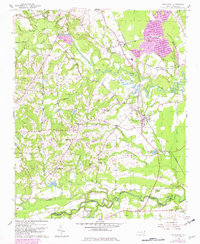
1956 Map of Bunnlevel
USGS Topo · Published 1982About this map
The confluence of the Little River and Lower Little River defines the landscape of the Harnett and Cumberland county line during the mid-20th century. This area is characterized by a dense network of rural infrastructure, including many family-named landmarks and community centers. Bunnlevel serves as a primary hub along the Norfolk Southern rail line, supported by smaller locales like Walkertown and Linden. The terrain is a mixture of agriculture and industry, evidenced by the numerous Sand and Gravel Pits and Brick Kilns located near the riverbanks.
Find a feature on this map
61 named features on this map. Tap any name to fly to it.
Don’t see what you’re looking for? This feature index may not catch every label — zoom into the map to look around manually.
Map Details
Editions of this 1956 Bunnlevel Map
2 editions found
Other maps of this area

1948 · Fayetteville
USGS Topo · 1:62,500

1948 · Slocomb
USGS Topo · 1:24,000

1950 · Manchester
USGS Topo · 1:24,000

1950 · Slocomb
USGS Topo · 1:24,000

1953 · Raleigh
USGS Topo · 1:250,000

1954 · Raleigh
USGS Topo · 1:250,000

1956 · Anderson Creek
USGS Topo · 1:24,000

1956 · Bunnlevel
USGS Topo · 1:24,000
1957 · Manchester
USGS Topo · 1:24,000

1957 · Fayetteville
USGS Topo · 1:62,500