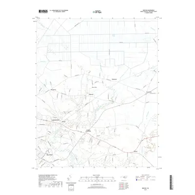
2019 Map of Bunyan
USGS Topo · Published 2019About this map
Washington and its eastern outskirts anchor this coastal plain landscape where the transition from town to timberland is defined by a complex network of wetlands and creeks. The community of Bunyan sits at a critical junction near the headwaters of Broad Creek, while further east, rural crossroads like Douglas Crossroads and Slatestone organize the interior farmlands. The terrain is notably dominated by expansive drainage systems, including the southern reaches of Dismal Swamp and the meandering Beaverdam Swamp, illustrating the persistent role of water in shaping Beaufort County's settlement patterns.
Find a feature on this map
89 named features on this map. Tap any name to fly to it.
Don’t see what you’re looking for? This feature index may not catch every label — zoom into the map to look around manually.
Map Details
Editions of this 2019 Bunyan Map
This is the sole edition of this map. No revisions or reprints were ever made.
Other maps of this area

1902 · Vanceboro
USGS Topo · 1:62,500

1903 · Chocowinity
USGS Topo · 1:62,500

1904 · Vanceboro
USGS Topo · 1:62,500

1905 · Chocowinity
USGS Topo · 1:62,500

1905 · Vanceboro
USGS Topo · 1:62,500

1943 · Plymouth
USGS Topo · 1:125,000

1950 · Pinetown
USGS Topo · 1:24,000

1951 · Bunyan
USGS Topo · 1:24,000

1951 · Bath
USGS Topo · 1:24,000

1951 · Hackney
USGS Topo · 1:24,000