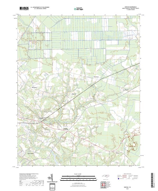
2022 Map of Bunyan
USGS Topo · Published 2022About this map
Washington and the surrounding Beaufort County landscape are defined here by a network of rural crossroads and coastal wetlands. The map details the transition from the structured street grid of the city's outskirts to the low-lying interior, where prominent features like the Dismal Swamp and Pungo Swamp dictate the local geography. Distinctive local names like Lizzard Slip Rd and Betsys Elbow reveal the character of a region where family-named roads and small settlements like Alligoods and Five Points have long formed the backbone of the community.
Find a feature on this map
84 named features on this map. Tap any name to fly to it.
Don’t see what you’re looking for? This feature index may not catch every label — zoom into the map to look around manually.
Map Details
Editions of this 2022 Bunyan Map
This is the sole edition of this map. No revisions or reprints were ever made.
Other maps of this area

1902 · Vanceboro
USGS Topo · 1:62,500

1903 · Chocowinity
USGS Topo · 1:62,500

1904 · Vanceboro
USGS Topo · 1:62,500

1905 · Chocowinity
USGS Topo · 1:62,500

1905 · Vanceboro
USGS Topo · 1:62,500

1943 · Plymouth
USGS Topo · 1:125,000

1950 · Pinetown
USGS Topo · 1:24,000

1951 · Bunyan
USGS Topo · 1:24,000

1951 · Bath
USGS Topo · 1:24,000

1951 · Hackney
USGS Topo · 1:24,000