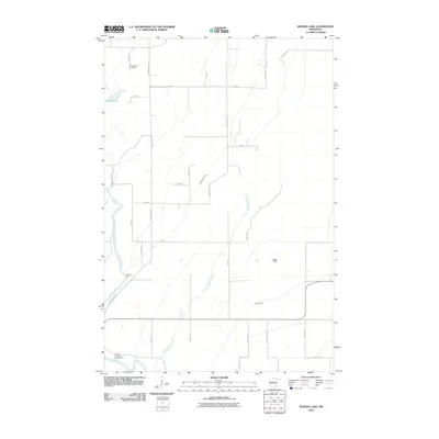
2010 Map of Burgen Lake
USGS Topo · Published 2010About this map
The Crow Wing River winds through this section of Wadena County, defining a landscape of low-lying wetlands and scattered rural landmarks. Near the northern boundary, Huntersville Cemetery provides a focal point for local genealogy, situated just east of Burgen Lake. The river's path is marked by historical crossing points and modern recreation sites, including Sweeney Ford and the Frames Landing Campground further downstream.
Find a feature on this map
29 named features on this map. Tap any name to fly to it.
Don’t see what you’re looking for? This feature index may not catch every label — zoom into the map to look around manually.
Map Details
Editions of this 2010 Burgen Lake Map
This is the sole edition of this map. No revisions or reprints were ever made.
Other maps of this area

1919 · Leader
USGS Topo · 1:62,500

1953 · Brainerd
USGS Topo · 1:250,000

1957 · Brainerd
USGS Topo · 1:250,000

1958 · Brainerd
USGS Topo · 1:250,000

1965 · Brainerd
USGS Topo · 1:250,000
1969 · Nimrod SW
USGS Topo · 1:24,000
1969 · Nimrod
USGS Topo · 1:24,000

1969 · Burgen Lake
USGS Topo · 1:24,000
1969 · Oylen
USGS Topo · 1:24,000

1970 · Spider Lake
USGS Topo · 1:24,000