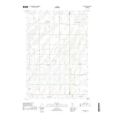
2019 Map of Burgen Lake
USGS Topo · Published 2019About this map
The Nimrod settlement and the surrounding marshy lowlands of the Upper Midwest are captured here, centered on the winding path of the Crow Wing River. This drainage network is defined by slow-moving water and significant wetlands, including Big Swamp Cr and Little Swamp Cr, which feed into the main river channel. Navigational challenges along the river are marked by Barrows Rapids and Weston Rapids, suggesting the river's historical importance for transit through these flat timberlands. The landscape is organized by a grid of county roads and section lines, with Huntersville Cem serving as a local landmark for genealogical research. The map illustrates the boundary between Wadena Co and Cass Co, showing how the land is divided across township and range lines in this part of central Minnesota.
Find a feature on this map
44 named features on this map. Tap any name to fly to it.
Don’t see what you’re looking for? This feature index may not catch every label — zoom into the map to look around manually.
Map Details
Editions of this 2019 Burgen Lake Map
This is the sole edition of this map. No revisions or reprints were ever made.
Other maps of this area

1919 · Leader
USGS Topo · 1:62,500

1953 · Brainerd
USGS Topo · 1:250,000

1957 · Brainerd
USGS Topo · 1:250,000

1958 · Brainerd
USGS Topo · 1:250,000

1965 · Brainerd
USGS Topo · 1:250,000
1969 · Nimrod SW
USGS Topo · 1:24,000
1969 · Nimrod
USGS Topo · 1:24,000

1969 · Burgen Lake
USGS Topo · 1:24,000
1969 · Oylen
USGS Topo · 1:24,000

1970 · Spider Lake
USGS Topo · 1:24,000