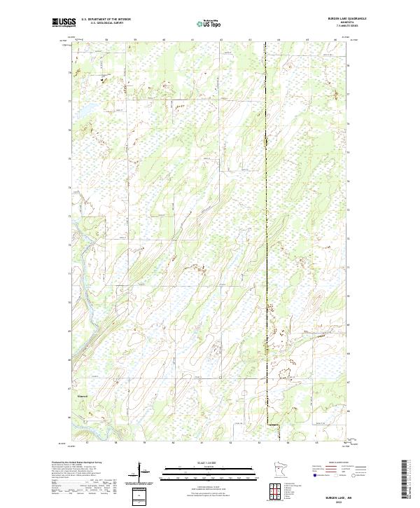
2022 Map of Burgen Lake
USGS Topo · Published 2022About this map
Nimrod serves as a primary settlement point in this corner of Wadena County, situated near the winding course of the Crow Wing River. The landscape is defined by its extensive wetlands and drainage systems, featuring significant watercourses like Big Swamp Creek and Little Swamp Creek. These natural features dictate the rural road network, which navigates around the saturated terrain to connect isolated farmsteads and the historic Huntersville Cemetery in the north.
Find a feature on this map
47 named features on this map. Tap any name to fly to it.
Don’t see what you’re looking for? This feature index may not catch every label — zoom into the map to look around manually.
Map Details
Editions of this 2022 Burgen Lake Map
This is the sole edition of this map. No revisions or reprints were ever made.
Other maps of this area

1919 · Leader
USGS Topo · 1:62,500

1953 · Brainerd
USGS Topo · 1:250,000

1957 · Brainerd
USGS Topo · 1:250,000

1958 · Brainerd
USGS Topo · 1:250,000

1965 · Brainerd
USGS Topo · 1:250,000
1969 · Nimrod SW
USGS Topo · 1:24,000
1969 · Nimrod
USGS Topo · 1:24,000

1969 · Burgen Lake
USGS Topo · 1:24,000
1969 · Oylen
USGS Topo · 1:24,000

1970 · Spider Lake
USGS Topo · 1:24,000